
The day began as it should for a UK hike: raining! I woke at 6 to start getting everything ready and started to rouse the troops at 7. It became readily apparent that this hike with one child deeply entrenched in her teenage years would provide challenges that we haven’t encountered on our past hikes. Waking a sleeping teenager can be challenging and a bit dangerous!
Jonah and I checked us out of the Premiere Inn at 7:30.

We headed down the street to Tibits for a wonderful breakfast. Lara and Olivia followed about half hour later.


We caught a tube ride from Waterloo to Paddington station to meet our train to Wales. We couldn’t leave the station without a photo of the local saint.

We took a 9:45 train to Chepstow with one short changeover in Newport. The kids took advantage of the long first leg of the ride to take naps.

At the Newport station, there was one food vendor and she happened to have great vegan options, so we picked up some large samosa-like lunch pastries for the hike and added some coffee (Lara) and Chai Lattes (Jonah and me) for some extra energy. We love that the theme of vegan options continued in the UK with non-dairy milk alternatives that came at no additional expense (please take note Starbucks!!)

And as Newport was our first Welsh town, we encountered the double-language signs for the first time. It is a national law that all signs be posted both in Welsh and English. Interestingly, under 20% of the Welsh population can actually speak/understand Welsh!

We had heard glowing reviews of the friendliness of the Welsh, but our first couple of encounters didn’t quite live up to the billing. One of the train conductors on the 15 minute ride from Newport to Chepstow came around asking for tickets; I had pre-purchased ours on the UK Trainline app but was not very familiar with it. I showed him what I thought was the ticket, but what turned out to be just the itinerary and all he said was, “Not a ticket.” So I got to another screen and heard again, “Not a ticket.” After the third attempt with the same reply, I asked whether he could help me figure out which screen had the tickets listed to which he said, “It’s not my phone.” Finally I found the ticket screen and he left us, but what remained was our first tag line of the trip: Not a ticket! We finally arrived in Chepstow a little after noon and were thrilled that we had made it AND that it wasn’t raining!

The actual start of the hike is several miles away so we opted to save time and energy by taking a taxi to the starting point - the irony of taking a cab two miles so we could hike 177 wasn’t lost on us! As we departed the station we saw one cab waiting and felt fortunate. I approached the driver and asked if he could take us to the start of the Offa’s Dyke Path (ODP). He just stared at me for what easily felt like more than a minute. I couldn’t tell whether he was in that small percentage of people who spoke Welsh (and maybe no English) or if actually had never of the Offa’s Dyke Path. It turns out he was just trying to determine if he wanted to bother taking us - the charm of the Welsh strikes again! I’m sure we’ll meet plenty of lovely Welsh people along the way; we just happened to be 0 for 2 so far. Fortunately he did take us most of the way to the start but told us the final 1/2 mile was a bit treacherous in his van so we’d have to walk from that point. I thanked him, paid him 5 pounds and then we departed, going through a stile to get on the path.

We hiked the final 1/2 mile to the starting point and found the starting stone. Though it lists the total mileage as 168, we have already been forewarned that the actual total distance is 177-miles (probably more once we add in any missteps and hiking off path to get to some of our lodgings.) The initial calculation of 168 was either just inaccurate or possibly the path has changed some since it was opened in 1971 by Lord Hunt, who was the leader of the first successful attempt of Mount Everest, in 1953.
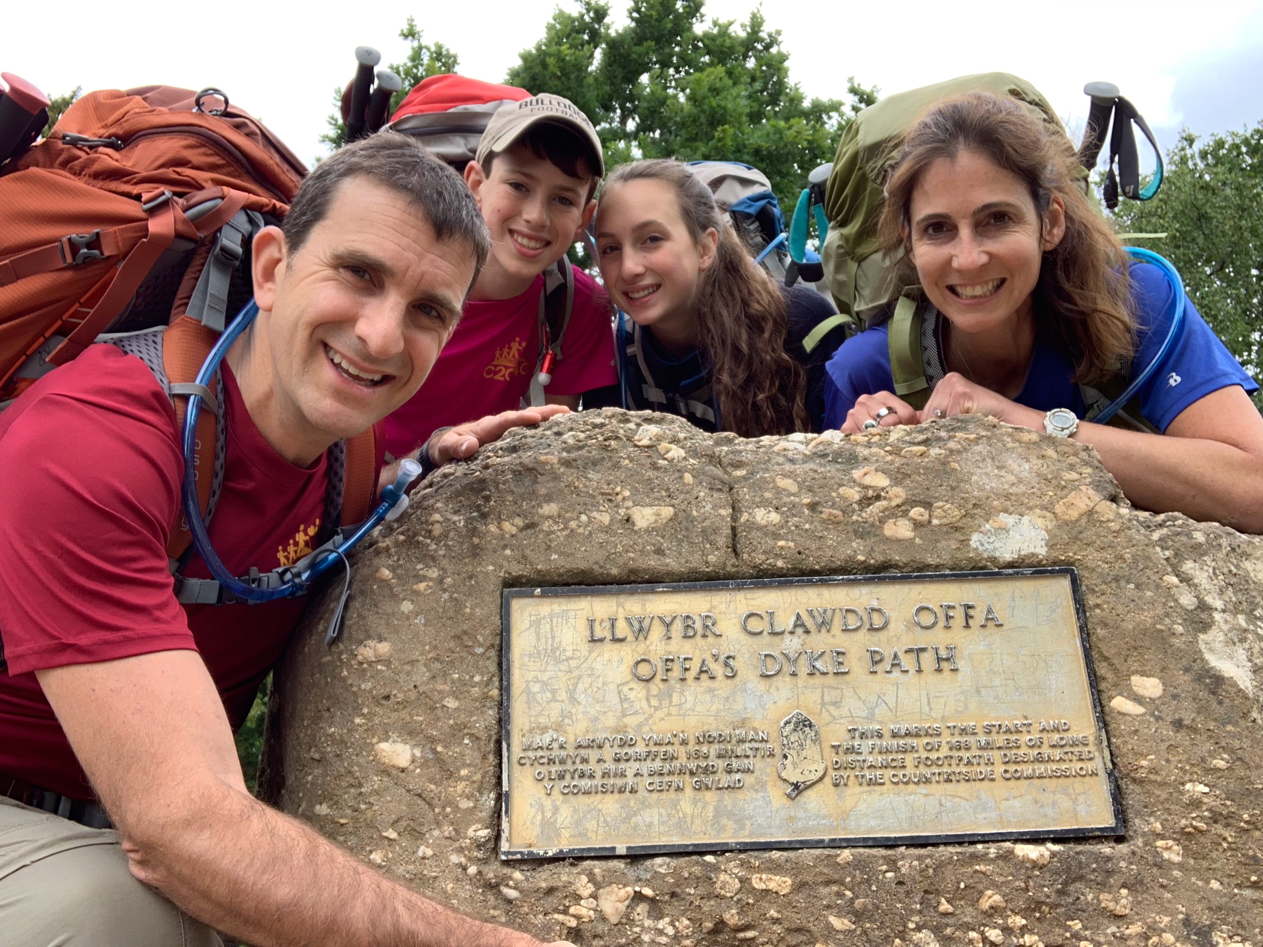
It is tradition on Coast to Coast trips to dip your heels (if you are walking and back tire if you are biking) in the water at the beginning of the trek and toes (or front tire) at the end of the hike. It’s also tradition to pick up a rock on the shore at the beginning and deposit it at the end. Since this hike begins high up on a cliff (Sedbury Cliffs to be exact), we had to forgo these traditions and settled for the obligatory start of the hike photos.

As we begin the hike, here’s a little history on it’s namesake. Approximately one third of the path follows the 8th century earthwork known as Offa’s Dyke. King Offa ruled Mercia (roughly today’s English Midlands) from 757 to 769CE. He had a dyke built to separate the western edge of his realm from the areas controlled by the princes of Wales. Henry V happened to have that title at one point, but not during Offa’s reign. The earthwork was made of a ditch and a bank (ditch on Welsh side) and possibly a fence on top of the dyke, though remains of the fence have never been found. From ditch to peak, the dyke was about 26 feet high and 88 feet wide and has been described as the most impressive monument of its kind in Europe. But enough with the history lesson - let the trek begin! And it did just before 1 pm.
The first part of today’s hike was my favorite as it was sunny and filled with the excitement of being back with my family on a C2C4C hike after a 2-year break. There is nothing like the freedom of being away from daily stresses, with the only daily objectives being to get from point A to point B, to eat, and to sleep. The rest of the time can be filled with the pleasure of being out in nature.

We came to the first of many acorn signs, the symbol of the Offa’s Dyke Path, so had to take a photo in front of it.

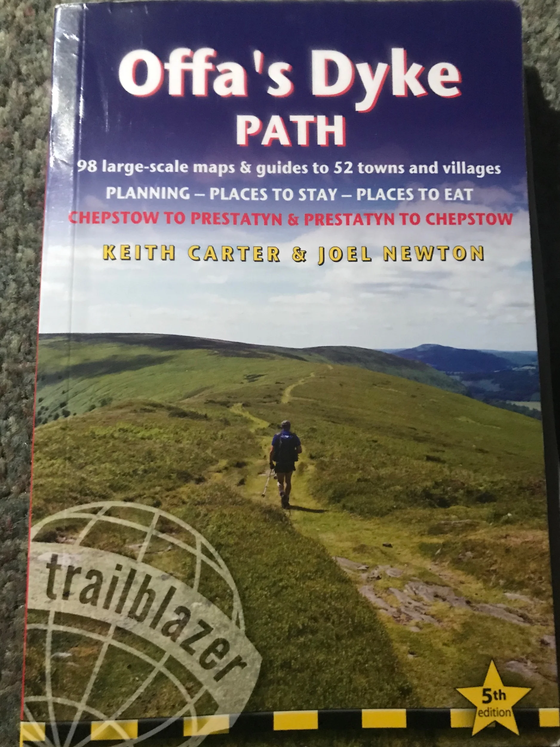
The path is well-marked with these signs - sometimes with the name of the path and sometimes with just the acorn symbol - so the only difficulties will likely be on the days when we have to go a bit off-path to get to our lodging. This happens to be one of those days. We learned fairly quickly that the book I have, part of the Trailblazer series, is fairly useless as the maps are not accurate or current. The Trailblazer book for our hike across England was wonderful, so don’t avoid all of the books in the series - just this one! Fortunately I also have the waypoints marked on my Garmin Fenix 5x plus, a nifty gadget I picked up a couple of months before the hike, and that kept us on track for the day.
I brought my ukulele and Jonah brought a plastic flute so we could have some jam sessions. He started the party early and played a little during the first part of our hike.

After the first half mile the scenery became less inspiring for a few miles- we knew to expect this - with the path skirting the edge of the Chepstow suburbs. I’d rather start the hike like this though than end with it (we are hiking south to north; some go the opposite way and end here.)
Once we got passed the Chepstow we were back in farmland and fields. Being in the open air is magical!


About half way through our hike, it started to rain and the rain stayed with us for the remainder of the day. It never was a downpour, but it was steady. We added bag covers and rain gear, though Jonah opted to stay in his t-shirt and brave the elements.

The directional difficulties began right after we reached Devil’s Pulpit, a high point on the trail that overlooks Tintern Abbey. The legend is that the devil would preach from this point, trying to tempt the monks from the abbey below to leave the abbey and follow him. It seems that none followed him though.

There were many signs that said “Public Path” diverging from the Offa’s Dyke, but none that told us which one might lead down into Tintern where we were lodging for the night. So we stayed the course longer than we needed to knowing that eventually the path would come to an obvious spot at which point we’d be able to turn into town. We trudged on for a couple of miles waiting for the path to descend, but it seemed to stay high above the River Wye. Finally Lara made the executive decision to try one of the alternate paths through a field. At this point we were ready to try anything as we were wet and had already hiked several miles more than we thought we would have to for the day. While it did meet back up with the ODP at the bottom of the field, it saved us about 1/4 mile.
Because of the rain, we were a bit short on photos for the day, but did manage to get a few good ones!

Each hike we’ve done has had days in which one child or the other struggles either physically or emotionally. It’s part of the challenge for the person and for the rest of us - how to get through those tough times. Usually those rough spells happen for the final few miles of a hike day. Today was Olivia’s day, starting with a struggle to get out of bed, and that struggle continued until the last mile of the day’s hike. (That’s why most of today’s pictures are of Jonah.)One of the many incredible traits of my wife is her patience. Another is her ability to uplift those around her. It took Lara almost the full day of hiking near and sticking by Olivia, knowing when to give Olivia space and when to tell her a story. Though the clouds never actually lifted, Olivia’s emotional one did thanks in large part to my amazing wife. We are all going to have our moments in the coming weeks and I’m grateful to know that I’m surrounded by a family who will uplift me when I have mine. We finally made it into Tintern and were happy to be near our lodging. The rain briefly stopped for us to take this photo at Old Station park entering town.

And then we arrived at our lodging for the night, Tintern’s Old Rectory just before 6 pm. Home sweet home!

It’s a cute establishment, and we have adjoining rooms for the night. After we all took warm showers, Lara washed and I wrung out some clothes. We heard so many bird songs that we thought there was a tape recording in the room. It wasn’t until we went back out for dinner that we realized that there were actually that many birds singing all around us. We headed down the road to the Wye Valley Hotel for dinner: a Mediterranean risotto with vegetables and salad. It was a perfect way to satiate our appetites at the end of our first day’s hike.
Shortly after returning to the room, the kids and I passed out a little before 9.

I think Lara went to bed about an hour later. I woke a little after 2 am to write today’s blog. It’s now about 5 am, and I will try to get a couple of hours more of sleep before we begin our next day’s adventure!
Daily Stats
Distance: 10:23 miles (not including our 0.5 mile hike to the start of Offa’s Dyke Path)
Time: 4:47 minutes
Average speed: 2.1 miles
Total Ascent: 1,463 feet
Total Descent: 1,522 feet